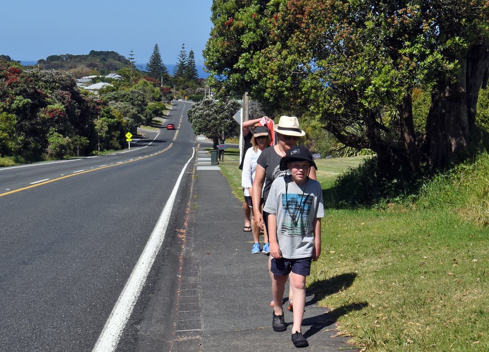
Experience Walking and Hiking
Leigh is at the centre of some great coastal and bush walks with spectacular views and a chance to see passing dolphins.
Must dos….
Walking and Hiking…
• Enjoy an easy stroll around the Leigh Harbour
• Get your heart really pumping with a hike up Mt Tamahunga
• Enjoy stunning scenery from just about everywhere!
Pick up a Leigh walking brochure from Warkworth Information Centre, Matakana Coast Information Centre, Leigh General Store or other local businesses. It features six of the best walks in the Leigh area. Or you can check out the walks below, then you just have to decide which ones to do.
NB: The Leigh Harbour Walkway is closed for Summer 2022/23 due to a slip.
Or if you want to check our the Matheson Bay walk from the comfort of your armchair, watch this video.

Grade 1: Mostly flat, easy walking.
Grade 2: surfaces vary, some steep sections or steps.
Grade 3: Some good climbs of moderate duration, muddy/slippery patches, well-formed tracks.
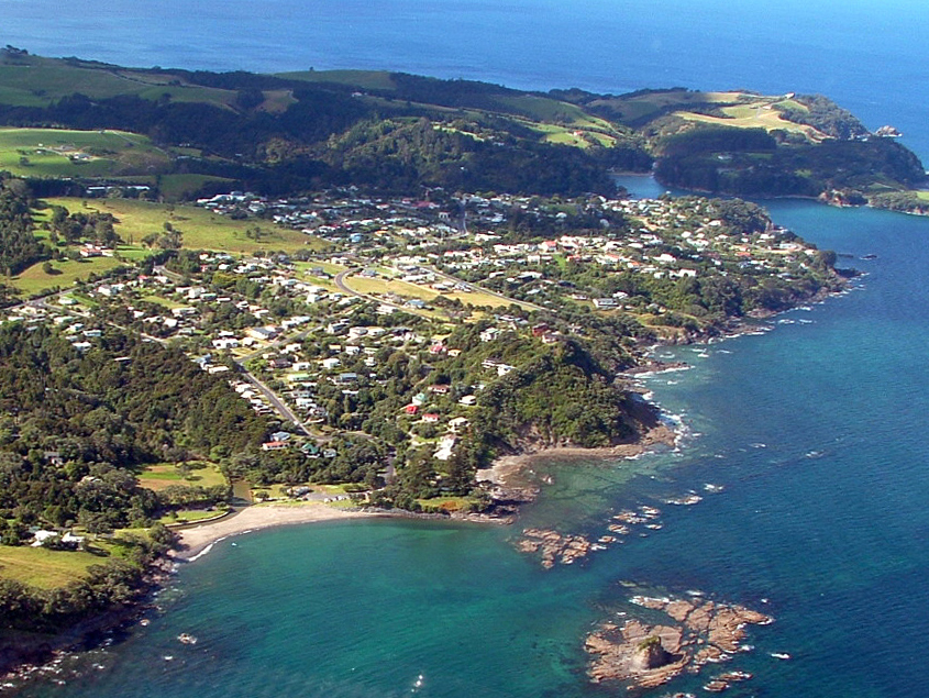
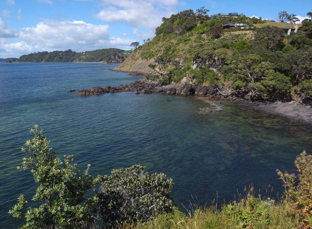
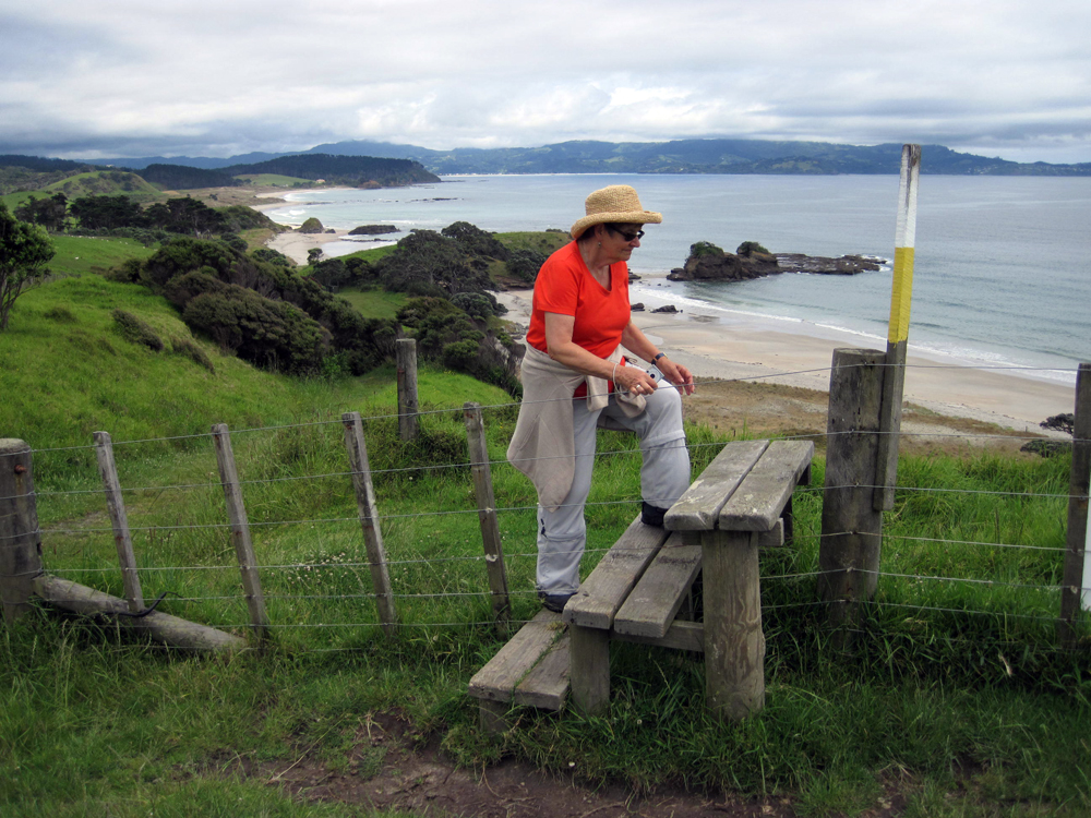
Leigh Coastal Walkway
One hour each way
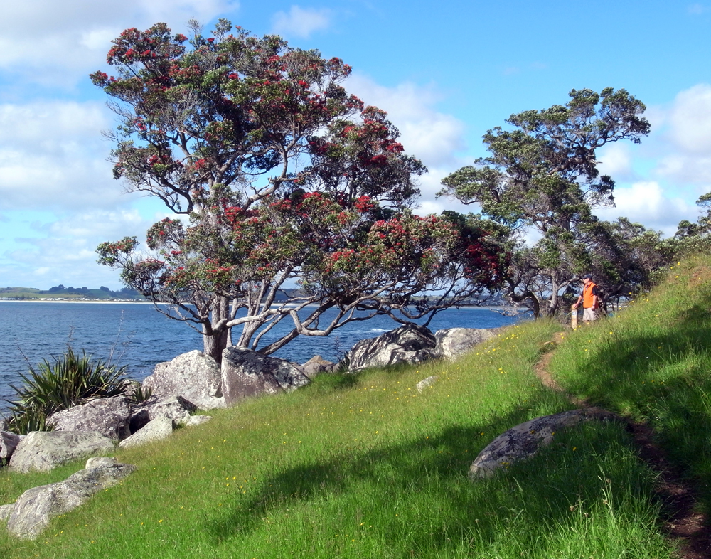
This stunning coastline is edged with large pohutukawa trees that bloom bright red in early summer. Views include Omaha Bay, Tawharanui Regional Park, Coromandel Peninsula, Little Barrier (Hauturu) and Great Barrier (Aotea) islands. Dolphins, orca and whales are regularly seen from the coast.
This walk can start at either the Leigh Cemetery on Harbour View Rd or from the bottom of Wonderview Rd and also accessed from the following roads: Kyle, Penguin, Cotterell, Kowhai, Cumberland and Harbour View. You can do it all or just part of it.
If starting at Wonderview Rd. Directly ahead, steps lead to Crabb Bay. (At low or mid tide, continue on to Matheson Bay around the rocks. 30mins.)To the right, a short track overlooks Daniels Reef, well known surfing spot. The coastal track starts from the left side, crosses the grass reserve, descends steps and follows the coast. A side track to a lookout has spectacular views over Daniel’s Reef and Omaha Bay.
The track follows alongside an electric fence down to a small pebbly beach. Cross the bridge and up the steep steps to Kyle St. Turn right, walk 30m to the walkway on the right between fences. Follow the signs and path through paddocks and coast, to the end of Penguin St. Enjoy the views across Omaha Bay from the seat.
Continue up the grassed reserve to a small set of steps and around in front of the houses to the reserve with clifftop pohutukawa at the end of Cotterell St. Head north, observe the very good views over Nordic Beach and Leigh Harbour, then descend to a series of steps over a small stream and through native bush. The steps ascend to Kowhai Tce which leads to the end of Cumberland St. Cross the grass reserve straight ahead, which leads to Harbour View Rd and the Leigh Cemetery. Remember to keep dogs on a lead as little blue penguins nest along this coastline.

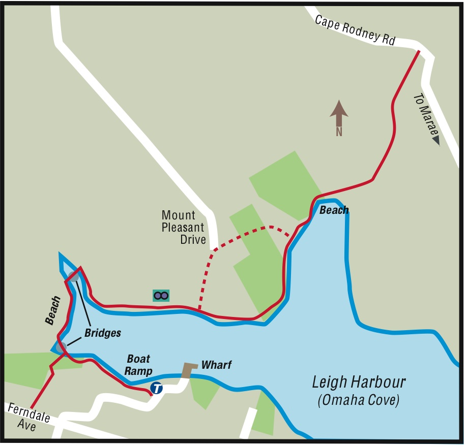
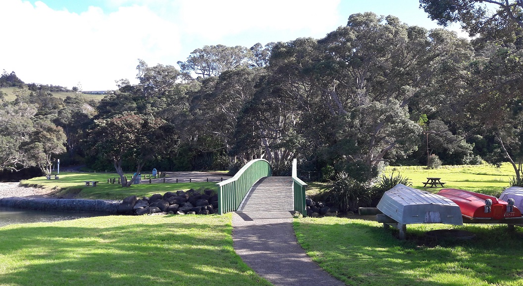
Leigh Harbour Walkway
NB: Currently closed past the second bridge for Summer 2022/23 due to a slip
One hour return
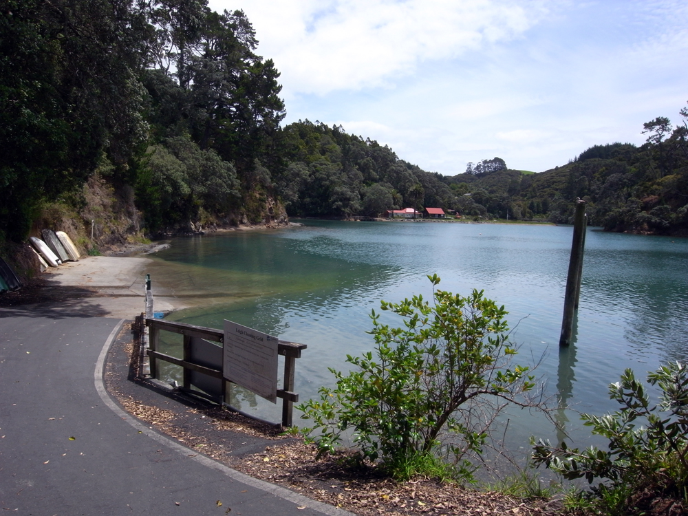
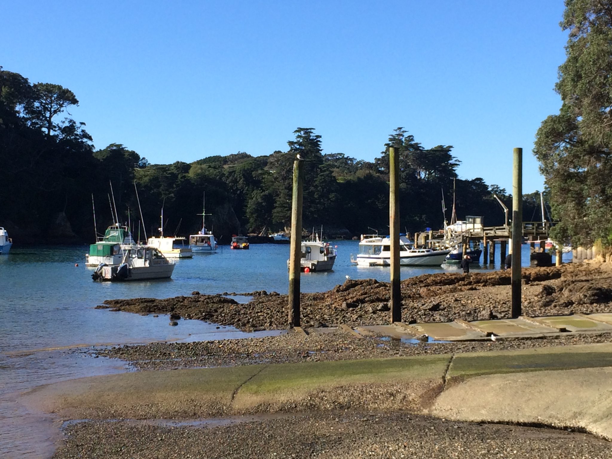
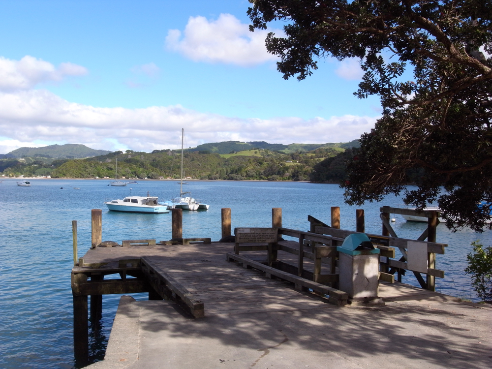
Begin at the Leigh boat ramp at the harbour and follow the track around the rocky shore to the top of the harbour. The start of the track may be covered at high tide and an alternative access is from Ferndale Ave.
From the bottom of Ferndale Ave steps, follow the top of the harbour, crossing two pedestrian bridges and a boardwalk to the Jolly Fisherman’s Lodge. Continue around the harbour to a second pedestrian bridge and onto the bush track. Continue alongside the edge of the harbour under shady trees. Take care as the track is narrow and drops steeply into the harbour. Lovely views of the fishing boats and across to the wharf.
Native bush includes ferns, kauri, nikau, pohutukawa and epiphytes beside the track. Birds you may see or hear include kaka, tui, warbler, fantail, cuckoo, kookaburra and kingfisher. Seabirds include seagulls, gannets, shags and white-faced heron.
A marked side track leads up a path through the bush to Mt Pleasant Rd where there is a good stand of kauri trees. It rejoins the track just short of the main sandy beach where the track finishes. At high tide, this is a good spot for a swim.
If tide permits, continue up the estuary across the sand flats to a road bridge on Cape Rodney Rd at low tide. You can turn left and continue up the very steep hill and walk back along the road to Pakiri Rd and back to Leigh. (An extra 40mins.)
Matheson Bay Bush Walk
40 minutes return
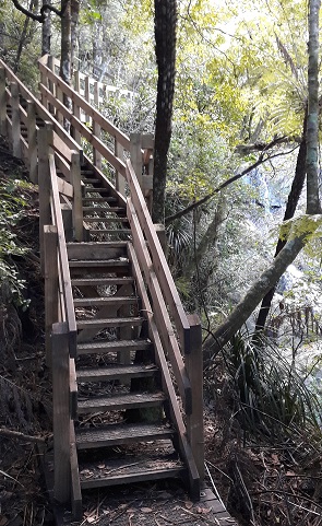
From Matheson Bay beach, this beautiful bush walk begins at the flat grassed reserve on the west side of the Kohuroa Stream. There are some steep sections as the track follows the stream and a series of waterfalls.
Native bush includes mature kauri, pohutukawa, rimu, totara and kaihikatea trees. Forest & Bird has placed some tree identification signs. There are also many nikau palms and ferns. The track has good boardwalks and steps through the steepest parts. At a large swimming hole there is a rope from a tree to swing out from to cool off. The track finishes at Leigh Rd where you can turn left and walk down Matheson Bay Rd to the bay. Birdlife includes kaka, kereru, welcome swallow, kingfisher and warbler.


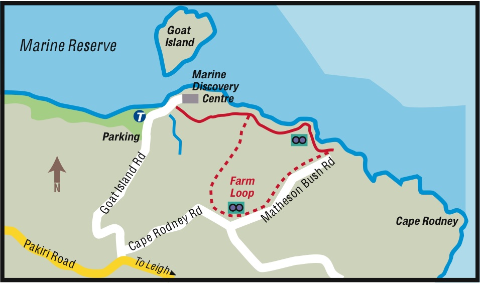
Goat Island Coastal Walk
1.5km 45-60 mins (one way)


You should park in the main Goat Island carpark. Walk down the hill and up the path to the Auckland University Marine Laboratory. The track starts at the signpost on the right hand side of the driveway.
The gravel track passes behind the University to the cliff-top with views over Goat Island to Pakiri and out to Little Barrier Island. Continue along the track which then descends into a valley with fine remnants of coastal broadleaf forest. It finishes at Tabletop Reef with spectacular views over the Hauraki Gulf and Hauturu or Little Barrier Island and the Hen and Chicken Islands.
A further section, through a kissing gate, follows the fence line to Matheson Bush Road. Continue along the road to Cape Rodney Road then turn right towards the lookout. Climb the stile to walk along the track around the farmland, towards Goat Island. The track rejoins the main track for your return. The section through farm paddocks can be muddy and there may be farm animals.

Goat Island to Okakari Point Walk
Three hours return
At low tide you can walk or rock hop west along Goat Island Beach. After about 30 minutes you will reach Pink Beach where the sand has a noticeable pink tinge from the broken shells that wash ashore. Continue around the rocks to Okakari Point where large yellow triangular marine reserve markers denote the western boundary of the marine reserve. The coastline has a mixture of sandy beaches, boulders and rocky shore. The rocky shore continues to Pakiri Beach. No fishing or collecting is permitted inside the marine reserve.

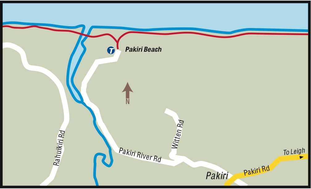
Pakiri Beach Walk
One hour return
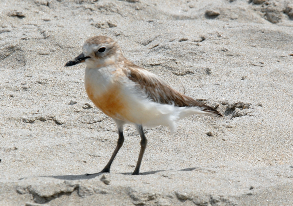
From the end of Pakiri River Rd, you can walk south along the beach towards Goat Island. This long, white, sandy beach offers a chance of getting away from the crowds. Best to check the tides as you should avoid walking within an hour of high tide. Sea birds seen here include oyster catchers, gannets, seagulls, Caspian and white fronted terns and NZ dotterels. At the end of the beach are a series of rock platforms with rock pools filled with beautiful big sea anemones and sea stars.
To walk north, you need to cross the Pakiri River, which is usually safe to cross. The beach continues north for around 14km to Te Arai and is backed by sand dunes.

Ti Point Coastal Walkway
Two hours return

Park at the end of Ti Point Rd, where there is a wharf and toilets. A gravel track and boardwalk follows the foreshore and passes very large, old pohutukawa trees and huge boulders along the shore line. Look out towards Omaha Beach and the entrance to the Whangateau Harbour.
Remember to keep dogs on a lead at all times as little blue penguins nest along this coastline.
The path narrows and continues alongside the coast. Some parts are shell paved and there are middens along the way. Plants include puriri, flax, bletchnum and nikau. Take care of tree roots which reach across the path. Stiles give access across the fence lines and there are several little sandy coves.
At the end you reach an open grassed area which is the Ti Point Scenic Reserve. Walk up the steep hill behind and alongside the fence line for good views out to Leigh Harbour and Little Barrier Island. Great views from here of the rocky outcrop, a spectacular basalt formation often used by rock climbers.


Te Araroa Walkway

The NZ walkway from Cape Reinga in the north to Bluff in the bottom of the South Island and this 11km section (4-5hrs) begins at Pakiri Beach and ends at Matakana Valley Rd, before continuing along Govan Wilson Rd and north east to Puhoi Valley.
From the Pakiri Beach access (adjacent to the camp ground), follow Pakiri River Rd for 3km to the intersection with Pakiri Rd. Cross over and continue south on Bathgate Rd, past the school and several houses. Beyond the southern end of Bathgate Rd, go down what looks like a driveway to the Te Araroa sign.
Follow the orange track markers leading up a steep ridgeline through farm pasture for 2.5km to a farm track near the end of Rodney Rd. This climb offers fantastic views up the coast. The track turns west through more farmland (farm tracks can be muddy in winter) and down/up a steep/muddy saddle (do take care when wet) before climbing through pine plantation into covenanted/DOC native bush. At the summit there is a helicopter platform which makes a good spot to rest a while. Continuing on, this rough and occasionally slippery track soon descends steeply before climbing again and walking beneath a weather satellite station. From there another rocky/slippery descent before the track levels out through regenerating bush. A “grassy knoll” affords some views (between the gorse) to the coast before continuing west on a well-formed track. That track leaves the ridge, crosses a stile and descends 200m to another stile before a narrow and slippery track takes walkers down, across a footbridge and to a short boardwalk across a swamp before another narrow, steep and slippery climb to Matakana Valley Rd. Head south on Matakana Valley Rd for 450m to the junction with Govan Wilson Rd. If in need of re-supply, Matakana is 6km south down Matakana Valley Road. Further information see Te Araroa.
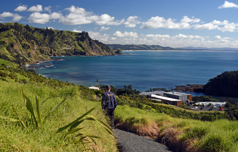
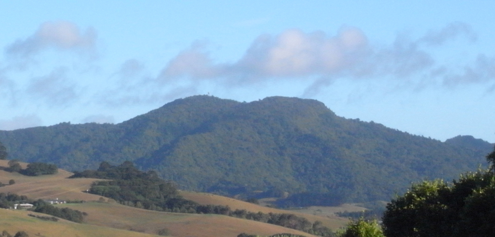
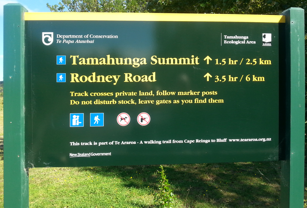
Mount Tamahunga Walkway
Access: The carpark and signposted track entrance is 3.5km up Omaha Valley Rd, off Leigh Rd. This track joins the Te Araroa – The Long Pathway just before the summit.
Distance and Time: to the summit 3km (1 hr 30 min one way); to Rodney Road 6.5km (3 hr 30 min one way); to the top of Matakana Valley Road, 5km (2hr 30 one way.)
The walkway initially climbs over farm paddocks to the bush line (please follow markers and use stiles to cross fences). Once in the bush, follow orange markers up the ridge to the summit and a helicopter pad. Views from the summit are restricted by forest, but several gaps in the track do provide views of the area.
From here you can retrace your steps or continue northwards to the Rodney Road exit. On leaving the bush, follow white markers up and down a steep route following a farm fence line until you exit onto a farm track, which joins with the end of Rodney Road. Enjoy magnificent views of the coast. You can also continue the walk from Rodney Road, 3 km across private farmland to the end of Bathgate Rd, Pakiri. Follow the white markers, please stick to the route and use the stiles to cross fences.
You can also turn west, on reaching the summit ridge / Te Araroa track and pass the Metrological Service Radar Station, then descend gradually to the Matakana Valley Road exit, on the northern side of the Matakana hill. Part of this track follows a buried / boxed in power cable.
More information can be found on the Department of Conservation website.


Tawharanui Regional Park

Located 25km south of Leigh, at the end of the Takatu Peninsula, Tawharanui Regional Park covers 588 hectares of the peninsula’s land and is administered by Auckland Council. The park is a mainland island with a predator free fence entrance. Natural recolonisation and relocation of birds into this predator free environment has made it possible for walkers to see many endangered birds. The numerous walks cater for all abilities and include bush, farmland, wetlands and beach, ranging from an easy 30 minutes to 3 hours. A walking map and more information is available on the Auckland Council website.

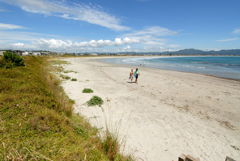
Omaha Beach
Located 17km south of Leigh, Omaha is a small beach town located on a sand spit that separates Whangateau Harbour from Omaha Bay. Formerly accessed only by boat, a causeway was constructed in the late 1960s and residential beach sections were developed. Coastal erosion resulted in the construction of three artificial groynes at the northern part of the sand spit, to accumulate sediment from longshore drift. Local council in last two decades had been placing various groups of plant to stabilize the dunes, including spinifex, pingao and marram grass.
This area is a recognised significant breeding ground for the endangered dotterel and there is a predator free fence. The walk around this area of the spit passes nesting birds and is best done at low tide. The beach is a curving 3km sandy beach, comprising 70% quartz. An undulating boardwalk from the surf club to the southern end of the beach gives an elevated view and there are a series of pouwhenua (carved Maori poles). A short walk around some wetlands is located at the southern end of the beach by the tennis courts.

Leigh & Matheson Bay Urban Walk
40-60 mins – All on sealed surfaces
Option 1: (Unable to do one hour either side of high tide)
From the Leigh General Store, walk straight down the road to Leigh Harbour. Take care as there is no path. At the bottom, turn left down to the boat ramp and continue along the old concrete driveway. Turn left and go up the stairs to Ferndale Rd. Turn right, first left into Puriri St. Turn right walk past the hall and continue along Pakiri Road, to the walkway opposite Leigh Fisheries.
Option 2: (When high tide makes the Harbour section impassable)
From the Leigh General Store walk northwest along Cumberland St, past the skateboard park, swings and hall. Cross the road and opposite Leigh Fisheries turn left onto the walkway.
Continuation of Option 1 and 2
This takes you to Albert St where you can cross the road to another walkway alongside the tennis courts and down to Seaview Rd. Cross the road to rejoin the walkway down to Hauraki Rd (the main road into Leigh.) Turn right to end of footpath, cross the road and walk up the hill past Wonderview Rd, to Grand View Rd.
When you reach Grand View Rd, you can either continue along the main road to Matheson Bay Rd and down to the beach (Matheson Bay extension) or walk along Grand View and turn left into Kendale for a shorter loop.
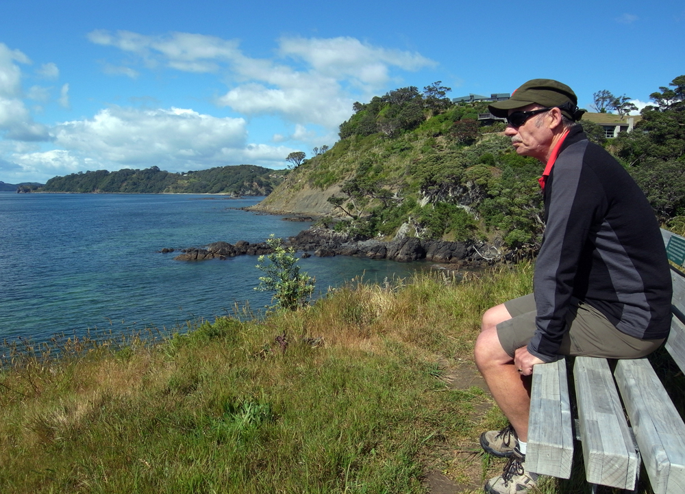
From the corner of Kendale, walk up hill onto newly sealed drive/walkway – sign is behind a big flax. At the top, sit on the bench and admire the view. Walk down the walkway to Lax Cr, turn right and walk to the end of the cul-de-sac. Walkway is on the left and continues to Wonderview Rd. Head up the hill, turn right into Barrier View Rd, walk to end and turn left into Cotterell St. Continue past Totara St, past Leigh Central and turn left into Cumberland St, passing Leigh Motors, Leigh Eats and back to the Leigh General Store.
Matheson Bay extension
From Matheson Bay Road, cross the walk bridge, past the toilet block and continue on up the hill. Approx. 100m on the right is a walkway with stepping stones to Hillside Crescent. At the top continue up Hillside then right onto Kendale Rd.


Schollums Road to Rodney Road Walk
2.6km each way – 45 mins each way
Park at the end of Schollums Road or go through the gate next to #441 Rodney Road. This wide track is a little steep and slippery when wet in places, but is mainly an easy gradient walk. On the way there are magnificent views overlooking Omaha and out to Hauturu and beyond. There is regenerating bush with mainly kanuka and manuka trees plus some puriri, lancewood and rimu, but also very large pine trees. There are also nice tree ferns along the way. At the Rodney Road end there are good views out to Pakiri Beach and beyond as well as Omaha. From the Rodney Road end you can continue on to Pakiri Beach or go to the end of Rodney Road and go along the Mt Tamahunga Track.